Skalkaho Bend Park
A place to explore 'many trails' along the Bitterroot River valley

Skalkaho Bend is a new public river park in Hamilton, featuring a short ADA accessible trail and meandering natural trails through the open meadows, river's edge, and riparian forest.
Features: A bench overlooking the river valley, native plants with signage along the ADA accessible trail, an educational sign on roots and erosion, wildlife viewing opportunities, and a variety of short, meandering, natural trails through diverse habitats.
Accessibility info and site description: Skalkaho Bend is located on the southwest corner of Hamilton, just south of River Park. There is a small gravel parking lot with no accessible parking, and an accessible restroom. At the entrance, there is a large map of the trails with the distances labeled, and a sign informing visitors that moose, bears, and mountain lions are occasionally seen here.
The first .1 mile is an ADA accessible trail that is wide, flat, and made of a natural material that looks like finely crushed rock. There are native plants planted along the trail with signage, and two educational signs on "native plants for wildlife" and "roots against erosion". There is a bench at the end of the ADA trail with a beautiful view overlooking the river valley, and a welcome sign explaining that the name Skalkaho is a Salish word meaning "many trails". Continue on the now-gravel path over the bridge and down a moderately steep hill to where this system of many trails begins.
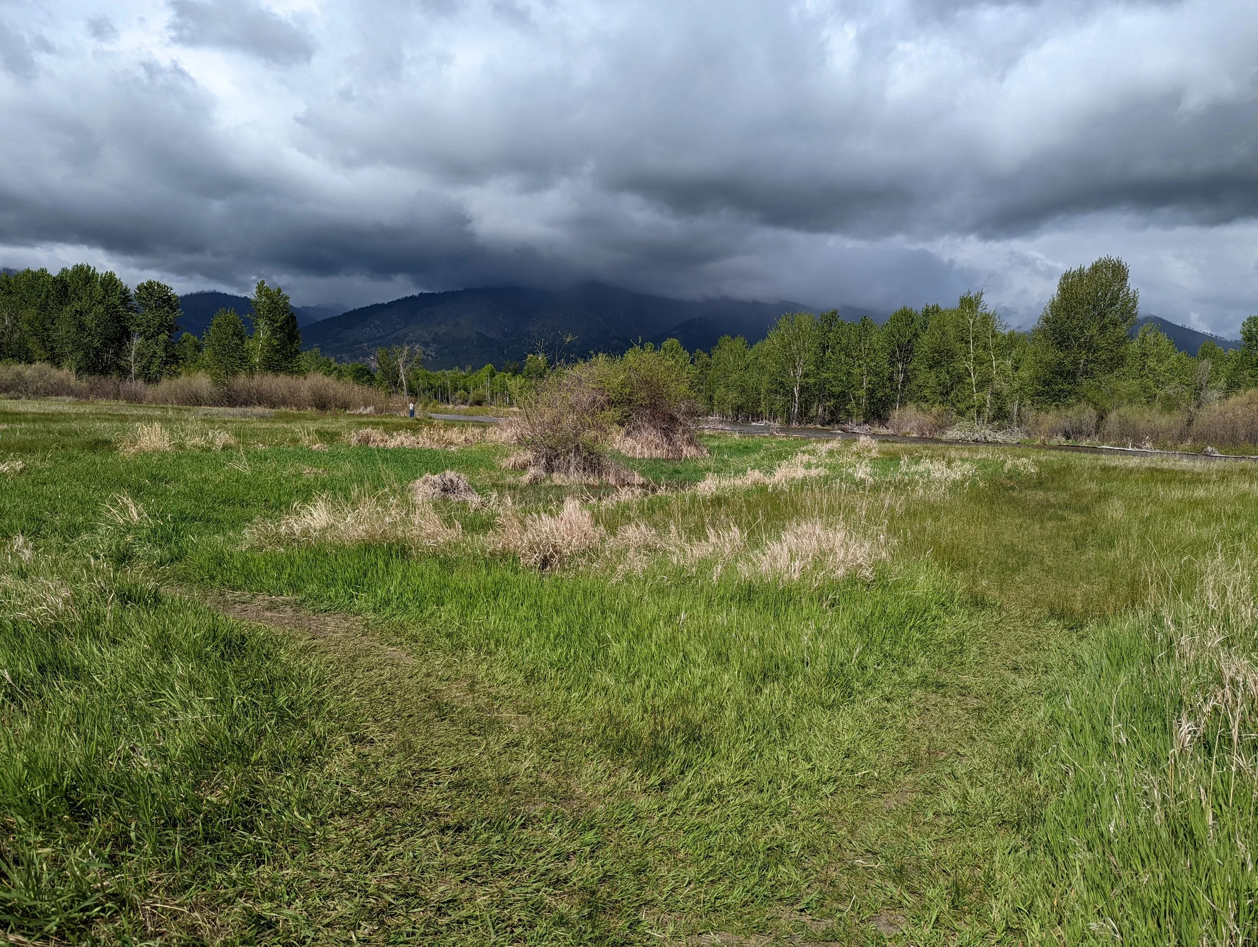
The trail to the south crosses a small footbridge, then splits and loops around an open meadow and to the river's edge, about .52 mile total. The two trails to the north are about .35 mile each. One goes through the meadow and one follows along the river's edge. Both lead to a forested area, where there is a .33 mile loop and the option to continue heading north another .2-.4 mile to meet up with the trails of River Park.
All of these trails are unmarked and undeveloped, indicated only by mowed or trampled grass, and are not always clear or obvious. The paths are mostly free of obstacles, with some areas of minor unevenness. The ground is firm, but there are some low spots that may become soft from rain or spring flooding.


My experience: This was my first time visiting Skalkaho Bend and I absolutely loved it. The ADA accessible trail is very well done and leads to an incredible view of the valley. Members of the community have done a beautiful job of gardening, landscaping, and tending to this space. It is clear that the locals cherish this valley and care about its conservation. At the entrance to this location, as well as others along the Bitterroot River valley, you'll find orange bags for collecting any trash you find on your visit, if you’d like to participate in the community effort to keep the rivers clean.
I recommend taking a picture of the map at the entrance before heading to the trails, because their unmarked and meandering nature makes it a little confusing at times to figure out where you're supposed to walk. But that's also what makes this spot so special: because of the goal to keep this space in its natural state, it feels like you're wandering through an open meadow rather than hiking with purpose down a trail. It fosters exploration, curiosity, and an intimacy with the river valley. With so many route options, you can plan as long or as short of a trip as you’d like. No matter which of the trails you choose to wander, the views are incredible from every direction. I look forward to spending more time here!
Overall, Skalkaho Bend is an amazing place to explore the Bitterroot River valley in its natural state. Visit this park to connect with the valley, learn about the native plants, and explore the diverse habitats!
For more information, visit:
http://www.cityofhamilton.net/living/parks_and_recreation/skalkaho.html
Download the trail map here:
https://bitterrootlandtrust.org/wp-content/uploads/2021/08/SB-Trail-Map-PNG-Aug2021.png